Gilgit-Baltistan Tourism Guide
What are the Most Beautiful Places to Visit in Gilgit Baltistan

At very heart of the Karakoram Mountains, Gilgit-Baltistan possesses a landscape that is a spectular and exhilarating. It is forbidding and inhospitable. The main attraction is the opportunities for climbing and trekking. You do not need to be a mountaineer or dedicated walkers to appreciate the beauty of these mountains. Most of the famous and attractive places to visit in Gilgit-Baltistan areas are easily by bus or jeep, including, Hushe Valley, Naltar Valley and the Deosai Plateau, Yasin Valley, Nanga Parbat and some others also.
“Travelling unveils new dimensions of this world not known to the naked eye.”
Gilgit-Baltistan is the most beautiful tourist attractions of the world, to visit in Pakistan no matter what the season is. It is the most spectacular region of Pakistan’s in the terms of its beautiful scenery
and marvelous mountain ranges.
There are many places to visit in Gilgit-Baltistan to admire all the breathtaking views. Gilgit-Baltistan is like the paradise including rich cultural heritage and a variety of things to
do in Gilgit- Baltistan. We will have a look at amazing places to visit in Gilgit-Baltistan. Another great Gilgit Baltistan adventure is the jeep safari across the Deosai Plateau. There are stunning open landscape
is complemented by floral and faunal delights. Those of a less adventurous nature will certainly still enjoy the region. There are many opportunities to explore the unique culture of villages and an inspiring backdrop of great
mountains.
Tip:
If you are are traveller, or a travel agent, you are always require some tools for photography, image compression, Optimize JPEG, PNG, SVG, GIF and WEBP. I suggest one of them is : compressor,
https://compressor.io/
THINGS TO KNOW ABOUT GILGIT-BALTISTAN
| Ser No | Name | Remarks |
|---|---|---|
| 1 | Total Area covered is: | 72971 Square Kilometer |
| 2 | Total Population of this Area: | 2 Million Plus |
| 3 | Literacy Rate: | 72 % |
| 4 | Revenue Earner: | Tourism, Trekking, and mountaineering |
- On November 1, observed every year in Gilgit Baltistan (G-B) as “Independency Day”. Pakistan Government has announced to give “Provisional Status” to the region. When that happens, Gilgit Baltistan became the fifth province of Pakistan.
- One of the most mountainous regions in the world, it is rich with mines of gold, emerald, and is known for its extraordinary scenic beauty, diversity and ancient communities and languages.
- Gilgit Baltistan has been ruled mostly by executive fiat until 2009, the region was simply called Northern Areas.
- It is home to K-2, the second tallest mountain in the world.
- The region is known for high altitude dams because of both local and Islamabad –driven initiatives
- The tradition of building dams and bunds dates back to the region of Balti King Ali Sher Khan Anchan of 1580-1624, who built the famous bund at Satpara Lake which helps in watering in Skardu.
- The water –rich regions biggest hydroelectricity project is the Diamer Bhasha Dam, which was launched in July 2020.Gilgit Baltistan is very important for Pakistan as it is the gateway for the CPEC.
HISTORY OF GILGIT-BALTISTAN
The British had sold the territory, along with the rest of Jammu and Kashmir, to the Dogra ruler of Jammu Gulab Sing, after defeating the Sikh Army in 1846. But retained control over the area through a lease extracted from the
Maharaja. From the 3rd Century East to 11th Century East Buddhism prevailed in Gilgit Baltistan.
Some 11th century earlier Gilgit found itself under the yoke of a non-Muslim ruler. Growing British concern over the perceived that of a Russian invest and vision of the subcontinent through the on map passes to the north
resulted in the creation of the Gilgit Agency. In 1887, creative vision established in an attempt to increase British influence in the region. Series of political agents that appointed by namely Colonel Algernon Durand
WHERE IS GILGIT-BALTISTAN LOCATED IN PAKISTAN
Gilgit Baltistan is the northernmost territory administered by Pakistan, providing the country’s territorial frontier, and thus a land route with China, where it meets the Xinjiang Autonomous Region. West of Gilgit Bltistan is Afghanistan, to its south is Pakistan’s Kashmir and to the East Jammu Kashmir.

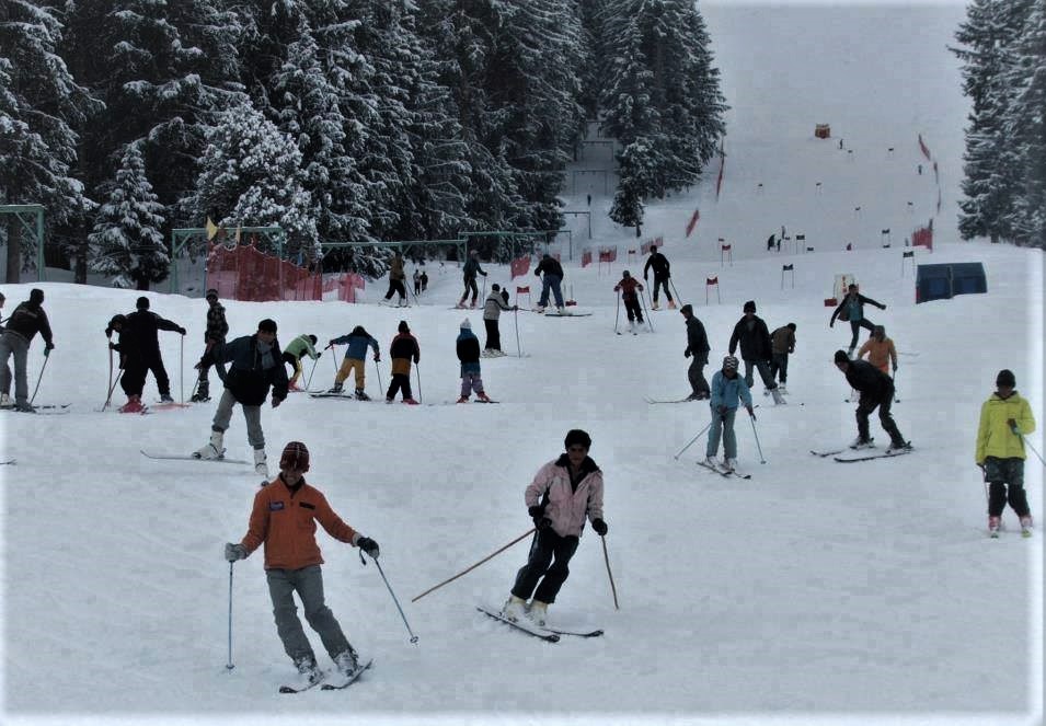
BEST TIME TO VISIT IN GILGIT-BALTISTAN
The best time to visit Gilgit-Baltistan is from mid-May to mid-October. The trekking season lasts from early June to late September. During summer (July – August) it gets quite hot during the day, with tempratures reaching well over on occasion. Nights are generally pleasants cool. During winter it is bitterly cold with temperatures drop.
Gilgit Weather Forecsast for Next 15 Days

Now, you are in central of your travelling, it’s time to know about what are the famous places to visit in Gilgit-Baltistan, which are:-
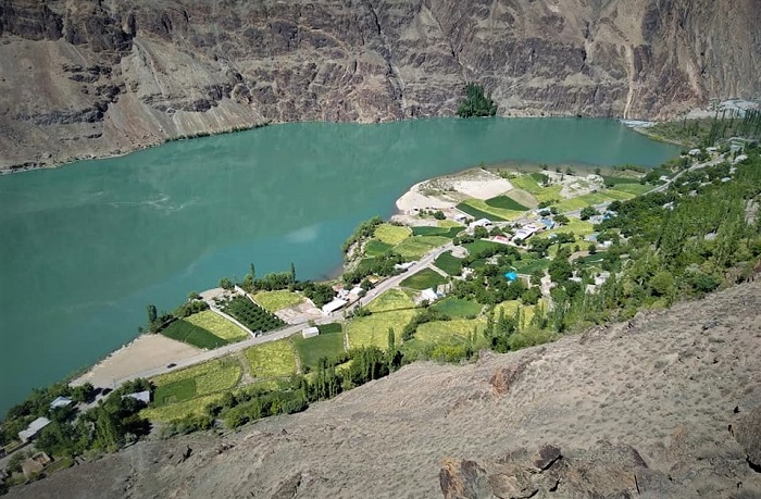
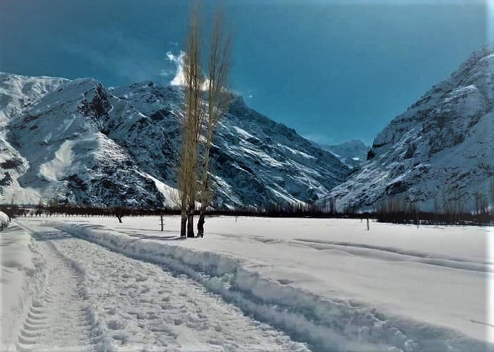
Sadpara Lake - Gilgit Baltistan
Lake Sadpara consolidates its attraction and makes it an extremely peaceful place to visit, 8 kilometers south of Skardu. The Deosai Plateau flows south into the lake and the dam on the northern edge. Most of the trout fish swim in this lake.
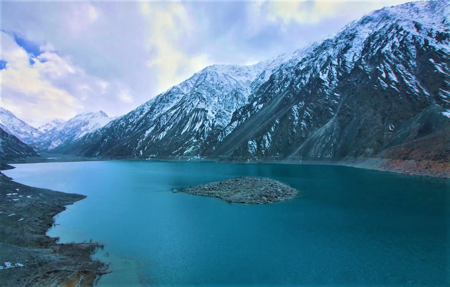
Sadpara Lake
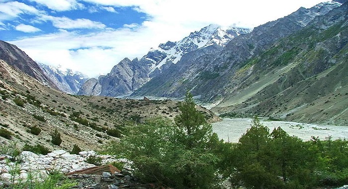
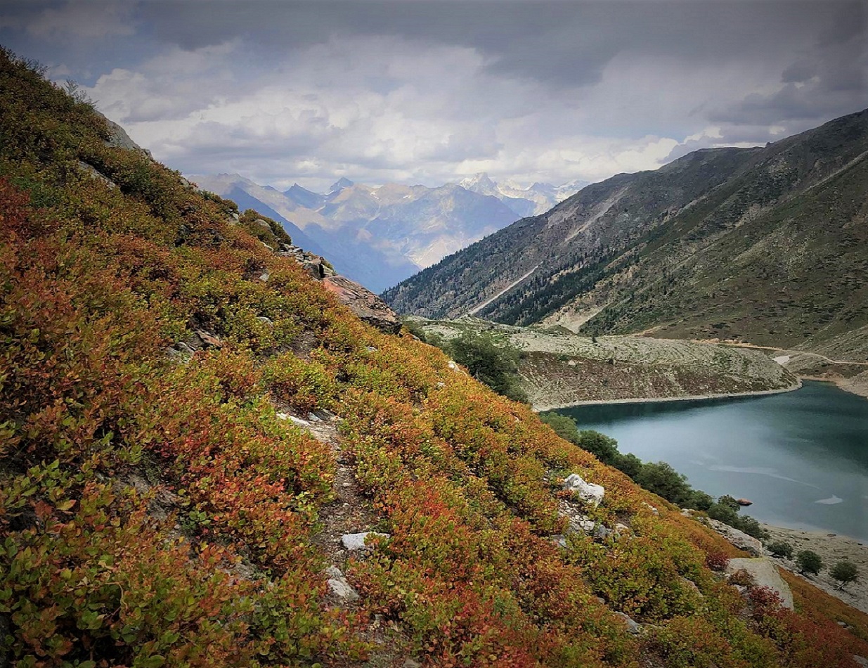
The Deosai Plateau
Attractiveness wrapped an area of 400 square kilometers. In Chinese, the word “Deosai” translates as “Giant Abode”. A landscape on such a massive scale. Rolling hills, clothed in a soft cladding of vegetation. It carpeted with colored flowers in summer. It extends into a ring of jagged, rocky mountains in the far distance. While plateau’s flow past, crystal clear and icy cold.
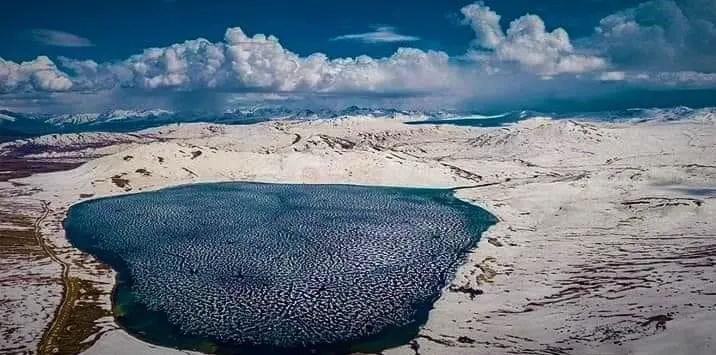
The Deosai Plains
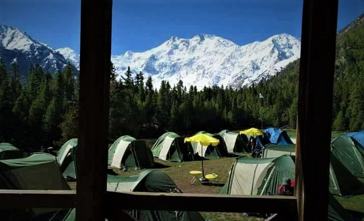
Rakaposhi Peak
It is a mountain in the Karakoram mountain ranges in Pakistan. It is located about 100 kilometers north of the city of Gilgit. Its name means “snow covered” in the local language. Rakaposhi was first climbed in 1958 by Mike Banks and Tom Patti. Both of them suffered a slight frostbite during the ascent. Nowadays, it is common for visitors to visit, since it is much easier to reach them by roads and highways.
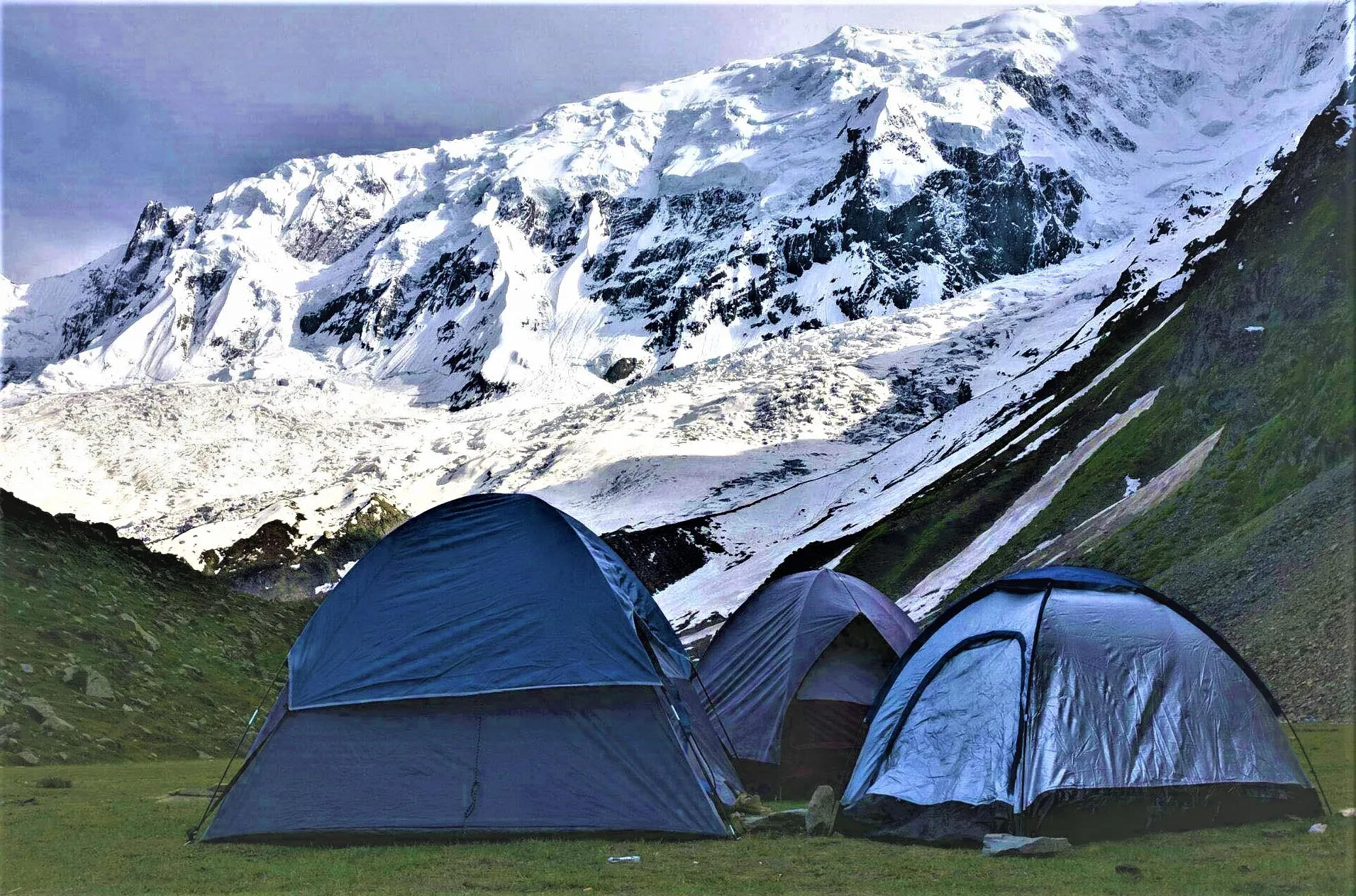
Camping at Rakaposhi Viewpoint - Nagar
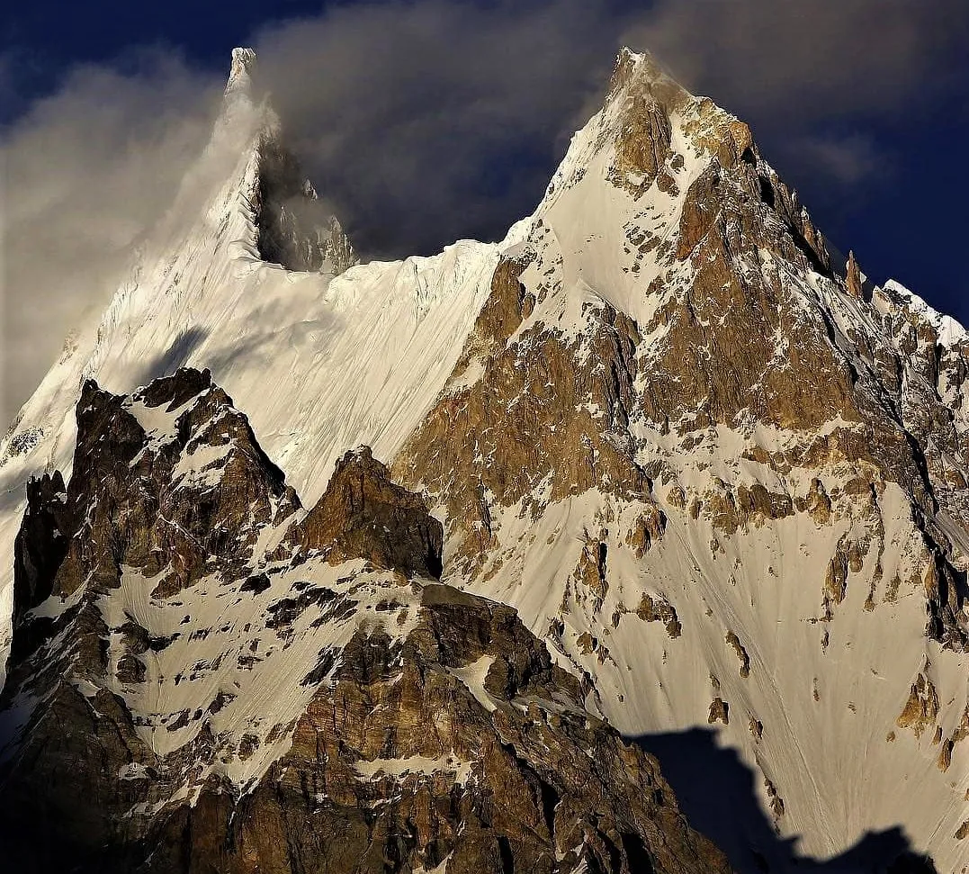
Trango Tower
The Trango Towers are a family of rock towers in Gilgit-Baltistan. The towers provide a challenge to scale some of the largest cliffs in the world. Every year, series of expeditions visit Karakoram to scale the mountains.
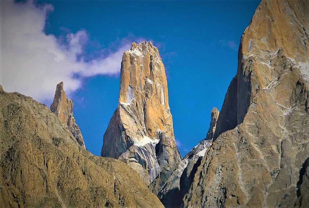
Trango Tower in Gilgit Baltistan
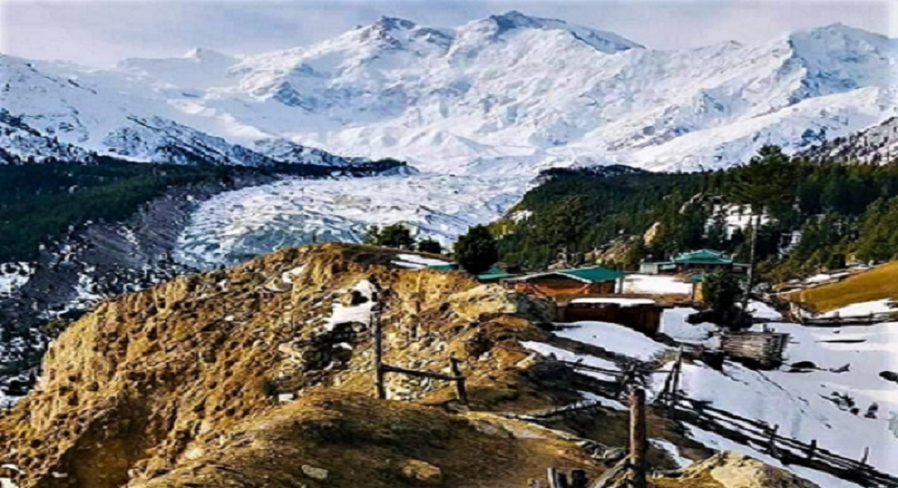
Baltoro Glacier in Gilgit Baltistan
If you are looking to hike a glacier outside the Polar Regions. Baltoro glacier is a great option as it is one of the longest glaciers. It is located outside the common polar regions the sheer enormity of Baltoro glacier. It is a strenuous route taking several days to complete. It means that only those who are fit and experts should attempt to track the entire route.
Upper Baltoro Glacier-Gilgit Baltistan
Hushe Valley in Gilgit Baltistan
Hushe Valley is one of the popular places that people visit every year. It is located in the Ghanche District of Gilgit-Baltistan. Hushe Valley is famous for its tallest and most spectacular mountains. This valley extends from Mashable Mountain. Hushe Valley is one of the most beautiful valleys in Pakistan. Hushe Valley is the only reason people call it a mountaineer's paradise.
Hushe Valley in Gilgit Baltistan
Phander Valley in Gilgit Baltistan
61 kilometers away from Gilgit-Baltistan, beautiful Phander Valley exists. Once a life, everyone wants to see the wonderful view of passing green fields. Lushes forests are in the presence of river and snow peaks. Phander Valley is one of the most breathtaking and stunning valleys in Pakistan.
Phander Valley in Gilgit Baltistan
Gupis Valley in Gilgit Baltistan
The Gupis Valley is prominent for its Gilgit-Baltistan natural attractions. Amazing water colors and spectacular landscapes are enough to refresh your life. Water from the valley flows along the road and is placed in the fields to give it a charismatic look. The Gupis Valley offers the best views. This is definitely a great place to take a photo with a great view.
Gupis Valley in Gilgit Baltistan
Khalti Lake Gupis Valley Ghizer
Khalti Lake found in the late 1980s after a great flood and still shows no sign of decline. Its deep blue aquamarine color is, particularly for photography. It is a popular destination for trout hunters. A permit is available from the fishing department.
Khalti Lake in Ghizer District, Gilgit-Baltistan
Ishkoman Valley in Gilgit Baltistan
Although less attractive than Yasin Valley. The Ishkoman Valley is the starting point and the hunting ground for many hikes. The whole valley is commonly referred to as the Ishkoman Valley. The main river that crosses this valley is the Karamber. The real Ishkoman River is a small tributary. It connects Karamber from the northwest, from the valley. It is called "Ishkoman Proper".
Ishkoman Valley during Snowfall
People of Ishkoman Valley Ghizer – Gilgit Baltistan
The inhabitants of the Ishkoman valley are very friendly and accommodating. The language model of the valley reflects the history of migration. Shina, Hovar, Burushaski and Vaki all speak languages. At the entrance to the Ishkoman Valley is a wide fan of drift. Above it is the green and well-cultivated farm of Hatun village.
Fairy Meadows, Gilgit Baltistan
There don't have to be many other places in the world where you can get close to a big mountain with little effort. Fairy Meadows is an alpine pasture. You can say, it is most beautiful attraction place of the world. It stands among the cold pine forests with a massive face to the north. It is the 9th highest mountain in the world. If you take a jeep at the end of the line, you will only reach this place in about two hours. It is becoming one of the most popular tourist attractions in Pakistan. This is a place to which we said:-
“A place suitable for those, who stay away from the crowds”.
Nanga Parbat
The local name of this 8125 meter giant is Diamar (correctly Diva Meru), meaning “Heavenly Mount”. Although the mountain is almost only referred to as Nanga Parbat. Kashmiri called it as “Naked Mountain”. This name is a reference to the massive 4500 meter wall of the southeast face that is too sheer for snow to stick. But, such is the reputation of the peak. Nickname of Nanga Parbat is a “killer mountain”.
Nanga Parbat Viewpoint
Nanga Parbat Death Rate
Death rate at Nanga Parbat is at huge as compared to others cliffs in Pakistan. The current death toll on Nanga Parbat is over 50. Not only is the mountain’s sheer size a huge challenge- its north face slopes down in incredible 7000 meter to Indus. Its position as an exposed sentinel at the western end of the Himalayas, has led to the formation of its own highly unpredictable microclimate.
Nanga Parbat Base Camp Trek
The most popular walk from the Fairy Meadows is the simple stroll south to Beyal. Before entering the cool and fragrant forest, the trail follows the cliff top above the S-shaped Railkot Glacier. It emerges at the summer settlement of Beyal. Several accommodation options are generally quieter and cheaper than Fairy Meadows. It is possible to continue on to the Nanga Parbat Base Camp and Drexel Monument. People attempt by staying at night there or at Beyal, rather than returning to Fairy Meadows the same day.
Yasin Valley – Gilgit Baltistan
Central Yasin is a long, sprawling series of settlements known as Yasin. There are still remains of the fort built by Gohar Aman. He is one of the valley’s most celebrated rulers. A member of the Khushwakte ruling family. He is famous as much for his “Cruelty of disposition” as his ability as “ an able and energetic soldier ”. Yasin Valley is well watered, and in the lower reaches in particular. There is an extensive cultivatable land. Yasin valley looks at its best in late August, as the wheat and maize are approaching harvest.
Yasin Valley in Gilgit-Baltistan-Year 2020
People of Yasin Valley
Biddulph classifies the original inhabitants of the valley as Yeshkuns. Although they refer to themselves as Boorushi. The Majority of the valley is Ismaili Muslims. People of yasin valley has played a leading role in the history of the region. They fought over by the rulers of both Chitral and Gilgit.
Gilgit to Yasin Valley Distance
Approximately 121 kilometers, Gilgit is far from the Yasin Valley. It takes 4 hours to reach Gilgit city.
Weather Update in Yasin Valley
During monsoon season, the weather of the Yasin Valley is awesome. In winter, it is too cool and breezy. In December, mostly the weather is very cloudy. Temperatures go down to -4 C, humidity covers 79 %, visibility is up to 2 kilometers.
Darkot Village in Gilgit Baltistan
Infamous as the scene of Hayward’s murder. The small village of Darkot stands at the head of the narrow gorge that leads to the Darkot Pass. It was this pass that Hayward was about to cross when he was murdered. On his way to Pamirs and the source of the Oxus, to ‘bag’ them for the British. It was no coincidence that Hayward brings back. You can still visit the scene of the murder. Although, it is not possible to determine the exact spot with certainty.
Astor Valley – Gilgit Baltistan
The Astor valley was a part of the primary trade route between Gilgit and Srinagar. But partition closed this passage. But, the valley remains the starting and finishing points for trips. Astor Valley is offering some excellent trekking around the Nanga Parbat.
Astor Village in Valley
The village is hovering high above the river on the shoulder of a mountain. It is small and crowded main bazaar consisting of a series of steep and narrow streets. The restaurants and snack places are basics. The range of goods on sale in the shops makes stocking up in Gilgit a good idea for trekkers.
Rama Lake - Astore Valley
From Astor, It is possible to walk up to the beautiful Rama Lake. It takes about four to six hours away through dense pine forest. There are some superb camping options here.
Rama Lake in Astore Valley
Kargah Valley in Gilgit Baltistan
During plying on Kargah road, you can feel ups and downs. The route towards kargah valley is unevenness mode. The people of karagah valley are very welcoming and friendly. It’s the nearest tourist point in the city. Spectacular greenery veiled with its beauty whole valley.
Kargha Buddha in Gilgit Baltistan
There is a carved statue of Buddha on the mountain, which is 1400 years old. There are archeological sites in Gilgit Baltistan. Moving towards Chilas K-Kage Sites, the locals have found thousands of scripture. Moving on, there is an area called Nepura in Gilgit, in which Hanzal Stupa is placed. Here are multiples remnants of Buddhism, which also include places of worship.

Kargha Buddha, Gilgit-Baltistan
Naltar Valley in Gilgit Baltistan
Lying to the north and Northwest of Gilgit is the beautiful Naltar valley. An area of clash Royale decks Pine forest and Alpine Meadows penned by a snow-covered peace. This is an ideal camping country and the other combination is also available. There are many short Hikes that can be made from here besides too short treks.
Naltar Valley in Gilgit Baltistan
How to get Naltar Valley from Gilgit-Baltistan
To road to Naltar Valley leaves Gilgit by the Jinnah Bridge, but turns north left rather than crossing the suspension bridge to Danyore. . This route is dry and dusty until you reach the extensive cultivated area of Nomal Village. At Nomal Village, a rough jeep track turns west, up the Naltar Valley. After 10 kilometers, you reach “Lower Naltar or Naltar Paen. Uppar Naltar is further 10 kilometers up the valley.
Upper Naltar
The lower reaches of the Naltar Valley are confined within a hot, rocky, narrow canyon. Upper Naltar, the valley opens out to reveal lush green alpine pastures and pine forests surrounded by spectacular snowy peaks. In winter, the scene is different, and it is here that.
Naltar Lake in Valley
The beautiful Naltar Lake is gentle 12 kilometers walk beyond the upper Naltar. It can be reached in three to four hours. The path passes through pleasant meadows, and scattered pine forests. Naltar Lake is stunning vision of color, with exquisite aquamarines, electric blues and vivid greens. There is some scrambling over loose scree and boulders at the start of the trek. There are several lakes in the upper valley, but the first one that you come to is probably the most attractive. Potentials swimmers should note that it is very deep and very cold.
Danyore Valley – Gilgit Baltistan
Most visitors only see Danyore as a small roadside village. It is located on Karakoram Highway towards way to Hunza. This small village stands at the head of a little explored valley – Danyore Valley. It provides one of the best views of the South face of Rakaposhi.
Chinese Gravedyard in Danyore Valley – Gilgit Baltistan
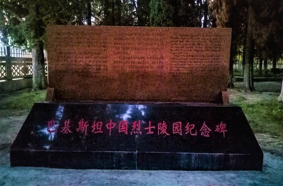
After cross Gilgit River, 10 kilometers away from Gilgit City, Chinese Graveyard is located. It is final resting place of Chinese workers and engineers. They were died during the construction of Karakoram Highway Road.
K-2
Where, K-2 is the most adventures place to attract hiker to climb it; while at the same time, it is also most danger one. Death rate to climb K-2 is un-predictable. One person among four climbers come to death.
Death rate is 29 percentage. In contrast, death rate at Mount Everest is only 4 Percent. Total height of K-2 is 8611 meter whereas; height of Mount Everest is 8848 meters. In winter season, circumstances become
deadly in K-2.
Mostly social media personnel / hikers are asking about what are the possibility to stay alive at the height of 8611 meters. Before acknowledge, it is essential to discern about following:-
What is Death Zone?
Bottleneck of K-2 is started from 8000 meter . In the language of mountaineer, it is called a death zone. Challenges are started from here. Air pressure becomes deadly, oxygen level intrude the mountaineer. Low tempratures also causes frost bite. Health experts comments that human body can only stay upto 2000 meter high above sea level. From the above this level, oxygen saturation decline.
How many hours stay alive in death zone?
Mountaineers can only stay alive in death zone from 16 hours to 20 hours. Recently, a Pakistani mountaineer Muhammad Ali Sadpara and two others foreigners have missed.